
Introduction
Search and rescue (SAR) operations are among the most time-sensitive and critical emergency responses in the modern world. Whether it is locating missing persons in dense forests, finding survivors after natural disasters, or conducting nighttime rescue missions, every second matters. Traditional methods such as ground patrols, helicopters, and manual scanning often face limitations in speed, visibility, and accessibility.
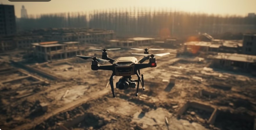
This is where UAV thermal imaging has emerged as a revolutionary technology. By combining unmanned aerial vehicles (UAVs), commonly known as drones, with advanced thermal imaging cameras, rescue teams can now detect heat signatures from humans and animals even in complete darkness or through obstructed environments like smoke, fog, or dense vegetation.
At Gulfnet, we recognize the growing importance of UAV-based solutions in emergency response systems. UAV thermal imaging is not just an innovation—it is becoming a necessity for modern search and rescue operations.
Understanding UAV Thermal Imaging
UAV thermal imaging refers to the integration of thermal sensors with drones to capture infrared radiation emitted by objects. Unlike traditional cameras that rely on visible light, thermal cameras detect heat differences and convert them into visual images.
Every object with a temperature above absolute zero emits infrared energy. Human bodies, for example, emit a distinct heat signature that can be easily detected using thermal sensors. UAVs equipped with these systems can fly over large areas and instantly identify heat anomalies.
Key components include:
- UAV (Drone platform)
- Thermal infrared camera
- GPS and navigation system
- Real-time video transmission system
- Ground control station
This combination allows operators to view live thermal data from the field, significantly improving situational awareness during emergencies.
The Role of UAV Thermal Imaging in Search and Rescue
Search and rescue missions are often conducted in unpredictable and harsh environments. UAV thermal imaging plays a crucial role in overcoming these challenges.
1. Locating Missing Persons Faster
One of the primary uses of UAV thermal imaging is quickly identifying missing individuals. Whether a person is lost in a forest, mountains, or urban rubble, their body heat stands out against cooler surroundings.
Drones can scan large areas in minutes, reducing search time from hours or days to just a fraction of the time.
2. Nighttime Operations
Traditional visual searches are almost impossible at night. However, UAV thermal imaging allows rescue teams to operate effectively in complete darkness, making nighttime missions significantly more successful.
3. Disaster Response
After earthquakes, floods, or landslides, victims are often trapped under debris. UAV thermal imaging can detect heat signatures through smoke and partially obstructed environments, helping locate survivors quickly.
4. Hard-to-Reach Areas
Cliffs, dense forests, collapsed buildings, and flooded zones are difficult or dangerous for human rescuers. UAVs can access these areas safely without risking additional lives.
Advantages of UAV Thermal Imaging in SAR Missions
The integration of UAV thermal imaging into rescue operations offers numerous benefits:
Speed and Efficiency
Drones can cover large areas rapidly, scanning terrains that would take ground teams hours or days to explore.
Improved Accuracy
Thermal imaging reduces human error by highlighting heat signatures that are otherwise invisible.
Safety for Rescue Teams
By reducing the need for physical entry into dangerous zones, UAVs significantly improve the safety of rescue personnel.
Cost-Effective Operations
Compared to helicopters or large-scale search teams, UAV thermal imaging solutions are far more economical.
Real-Time Data Transmission
Live streaming of thermal footage allows command centers to make immediate and informed decisions.
How UAV Thermal Imaging Works in Real Missions
A typical SAR mission using UAV thermal imaging follows a structured workflow:
- Mission Planning
The search area is mapped using GPS coordinates and divided into sections. - Drone Deployment
UAVs equipped with thermal cameras are launched from a safe location. - Aerial Scanning
The drone flies over the designated area, capturing infrared data. - Heat Signature Detection
The system identifies anomalies that may indicate human presence. - Data Transmission
Live thermal footage is transmitted to the control center. - Verification and Ground Response
Rescue teams verify the findings and move to the exact location.
This structured approach significantly enhances operational efficiency and success rates.
Applications of UAV Thermal Imaging in Search and Rescue
1. Mountain and Forest Rescue
Hikers, climbers, and travelers often get lost in remote areas. UAV thermal imaging helps locate them quickly even under thick canopy cover.
2. Flood and Water Rescue
During floods, UAVs can scan water surfaces to detect stranded individuals or floating survivors.
3. Earthquake Response
Collapsed buildings trap victims under debris. Thermal sensors can detect body heat beneath rubble.
4. Industrial Accidents
In factories or oil fields, UAV thermal imaging helps locate injured workers in hazardous zones filled with smoke or fire.
5. Urban Search Operations
In crowded cities, drones assist in locating missing children or elderly individuals efficiently.
Technological Advancements in UAV Thermal Imaging
The evolution of UAV thermal imaging has been rapid in recent years. Some key advancements include:
AI Integration
Artificial intelligence now helps automatically identify human heat signatures, reducing manual analysis time.
Higher Resolution Sensors
Modern thermal cameras provide clearer and more detailed images than ever before.
Extended Flight Time
Battery improvements allow UAVs to stay airborne longer, covering larger areas in a single mission.
Multi-Sensor Fusion
Combining thermal imaging with optical cameras and LiDAR improves detection accuracy.
At Gulfnet, we continuously explore these advancements to enhance operational effectiveness in emergency response systems.
Challenges and Limitations
Despite its advantages, UAV thermal imaging does face some challenges:
Environmental Interference
Extreme weather conditions like heavy rain or strong winds can affect drone performance.
Heat Source Confusion
Objects like rocks or machinery that retain heat may sometimes be mistaken for humans.
Limited Battery Life
Although improving, UAV flight time is still limited and may require multiple units for large-scale operations.
Regulatory Restrictions
Airspace regulations can restrict UAV operations in certain regions.
However, ongoing technological improvements are steadily addressing these limitations.
Future of UAV Thermal Imaging in Search and Rescue
The future of UAV thermal imaging is extremely promising. With advancements in AI, automation, and sensor technology, drones will become even more autonomous and intelligent.
Expected future developments include:
- Fully autonomous SAR drones
- Real-time AI-based victim identification
- Swarm drone technology for large-area searches
- Integration with emergency response systems
- Enhanced predictive analytics for disaster management
These innovations will further reduce response time and improve survival rates in emergencies.
Gulfnet’s Role in Advancing UAV Thermal Imaging
At Gulfnet, we are committed to leveraging advanced technologies like UAV thermal imaging to enhance safety and operational efficiency in critical missions.
Our focus includes:
- Deploying smart UAV systems for emergency response
- Improving thermal imaging accuracy and reliability
- Supporting organizations in disaster preparedness
- Integrating modern data analytics with aerial surveillance
We believe that UAV thermal imaging is not just a tool but a life-saving technology that can redefine how search and rescue operations are conducted globally.
Conclusion
In modern emergency response systems, speed, accuracy, and safety are essential. UAV thermal imaging has proven to be a game-changing technology in search and rescue operations, enabling faster victim detection, safer missions, and more efficient use of resources.
From dense forests to collapsed buildings, and from night-time searches to disaster zones, UAV thermal imaging continues to redefine the boundaries of what is possible in rescue operations.
At Gulfnet, we are proud to support and promote this transformative technology, helping rescue teams save more lives with greater precision and efficiency. As the technology continues to evolve, UAV thermal imaging will undoubtedly become a standard tool in every modern search and rescue mission.